Windstorm - Take Cover - Danger! Danger!    Read More >

Waterfront Walkway


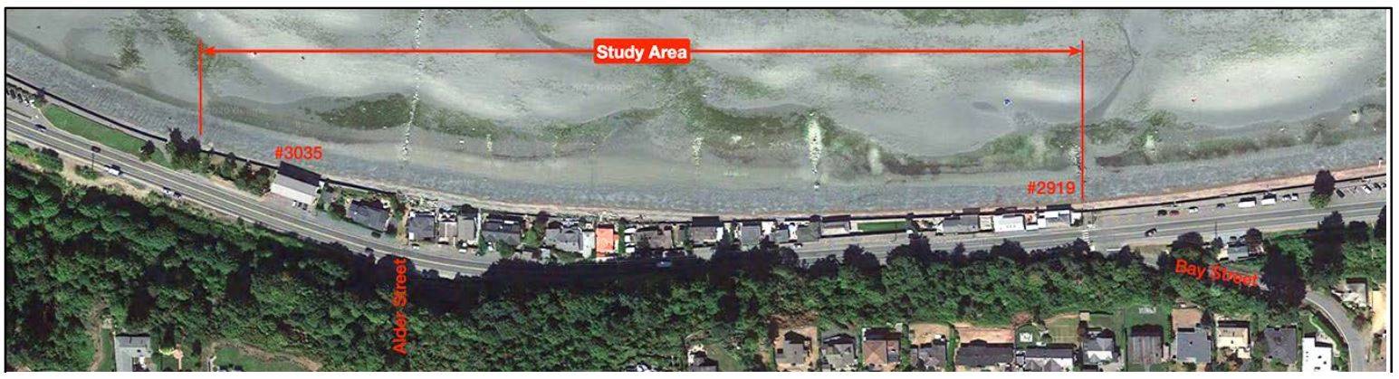
The Town has a long-standing goal of establishing a safe, continuous walkway along the Qualicum Beach waterfront.

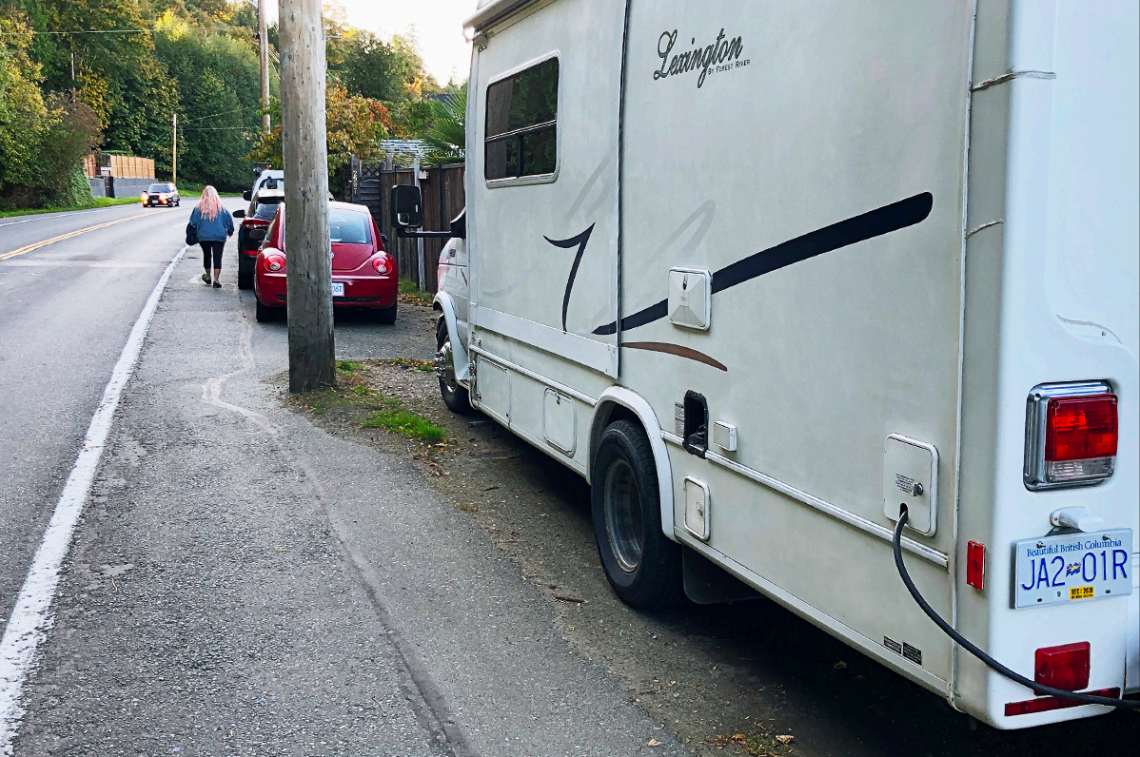
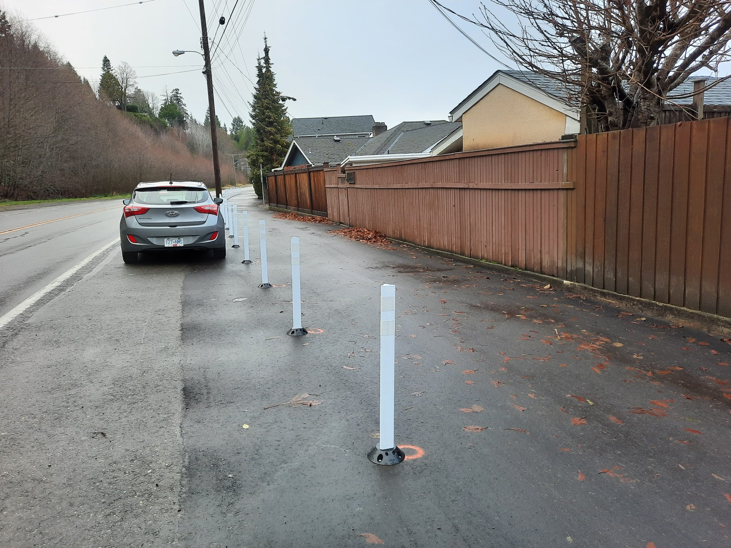
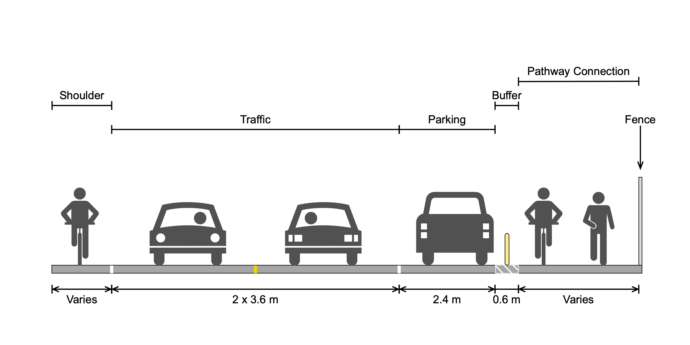
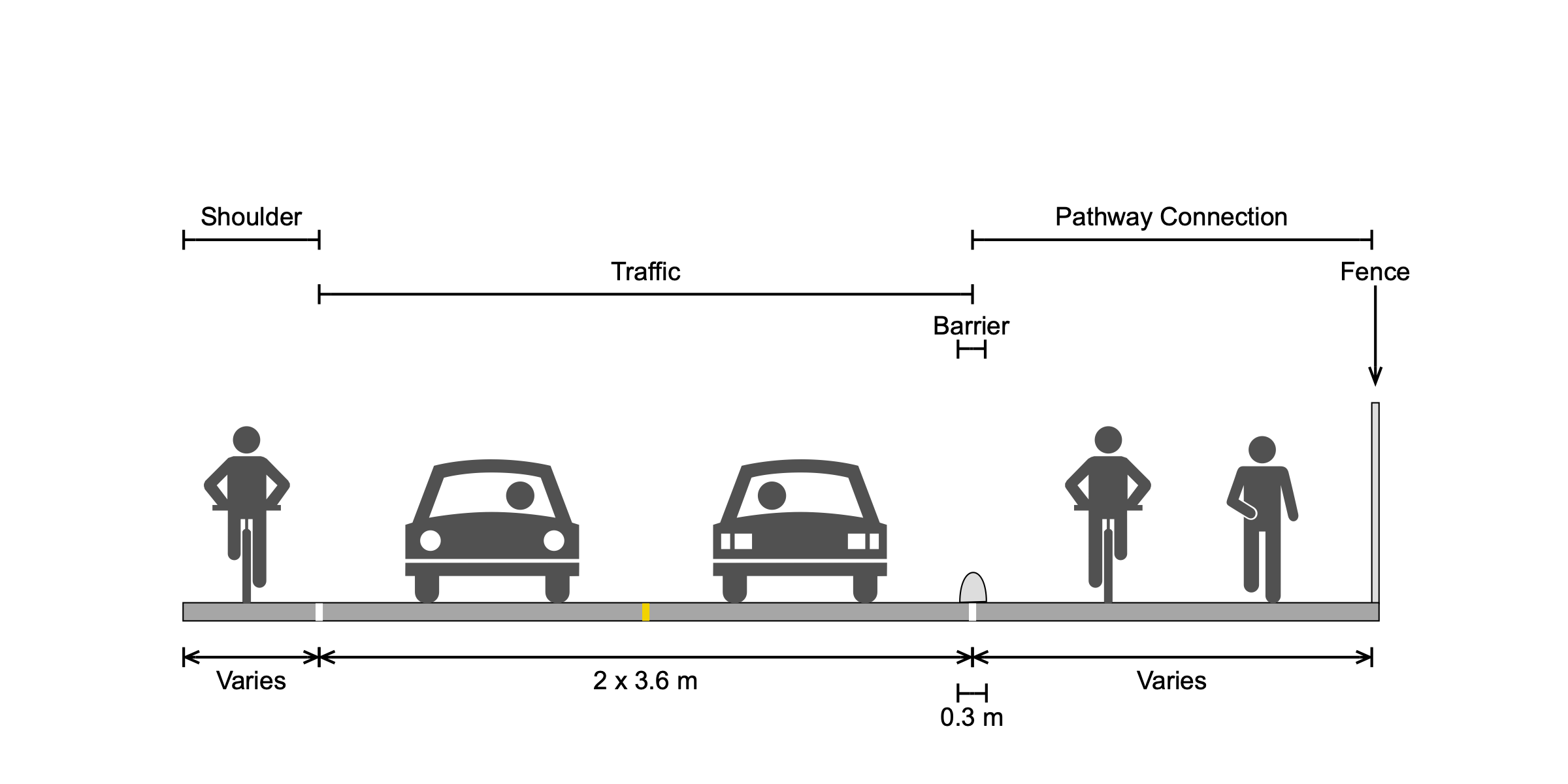
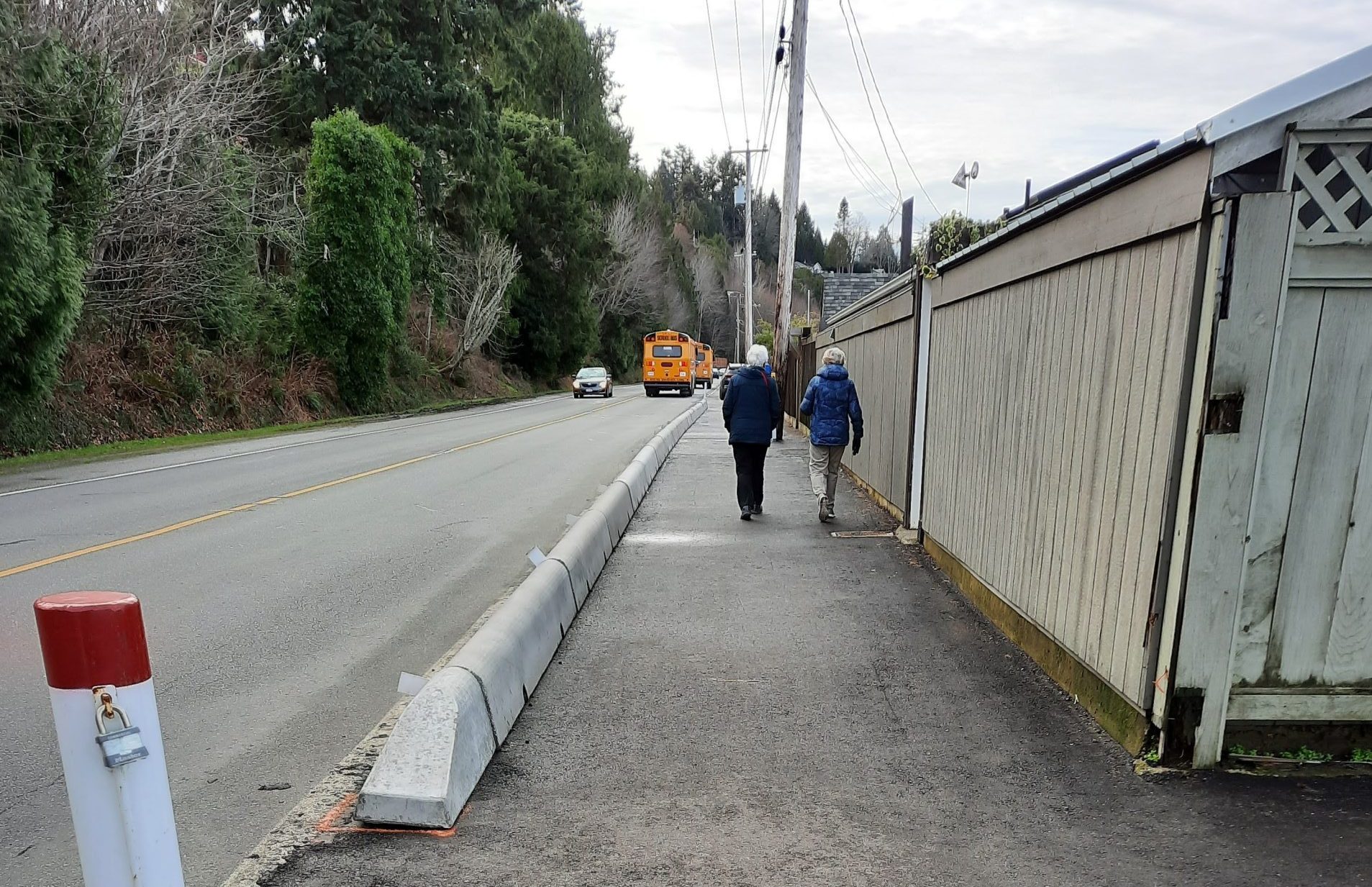
This project designated parking spaces along Highway 19A through the placement of bollards and two-way pedestrian and bike lanes protected by concrete barriers. Previously, private properties obstructed the walkway, and walking along those stretches was dangerous and onerous.

This project advanced the goals of the Waterfront Master Plan and created a continuous walkway along the waterfront for all to safely enjoy.

A person walks down a narrow walkway between parked cars on the right and a road with an approaching car on the left.
A walkway under construction, with a road on the left blocked by poles to prevent parking, and a fence on the right side of the path.
Photo of the Waterfront Walkway, with two people walking, a road on one side, and a fence on the other.
An aerial view of the beach with houses along the shoreline, a road, and a red line marking the
A graphic showing the space distribution on a road before the new path was built, with sections for the road shoulder, cars, parking, a buffer, and the pathway for residents.
A graphic showing the space distribution on a road, with sections for the road shoulder, cars, a buffer, and the newly added pathway.
A person walks down a narrow walkway between parked cars on the right and a road with an approaching car on the left.
A walkway under construction, with a road on the left blocked by poles to prevent parking, and a fence on the right side of the path.
Photo of the Waterfront Walkway, with two people walking, a road on one side, and a fence on the other.
An aerial view of the beach with houses along the shoreline, a road, and a red line marking the "study area" over the water. This is a map highlighting the area where walkways have been implemented.
A graphic showing the space distribution on a road before the new path was built, with sections for the road shoulder, cars, parking, a buffer, and the pathway for residents.
A graphic showing the space distribution on a road, with sections for the road shoulder, cars, a buffer, and the newly added pathway.
  • Spring 2020  – Project commencement
  • Spring 2021  – Project completion